Seven Lakes Valley Hike: Quick Guide
The Seven Lakes Hike, also known as Triglav Lakes Hike, is a classic Julian Alps route through high alpine pastures and limestone karst, linking lakes and mountain huts.

Uroš
Published March 11, 2026
Edited April 17, 2026
12 min read
Quick links
Quick Facts
Trail type: out-and-back
Distance: 15.2 km
Time needed: about 6 hours
Elevation gain/loss: 1,051 m
High point on the route: Štapce 1,851 m
Turnaround landmark: Koča pri Triglavskih jezerih (1,685 m) by Dvojno jezero (Double Lake)
About the Trail
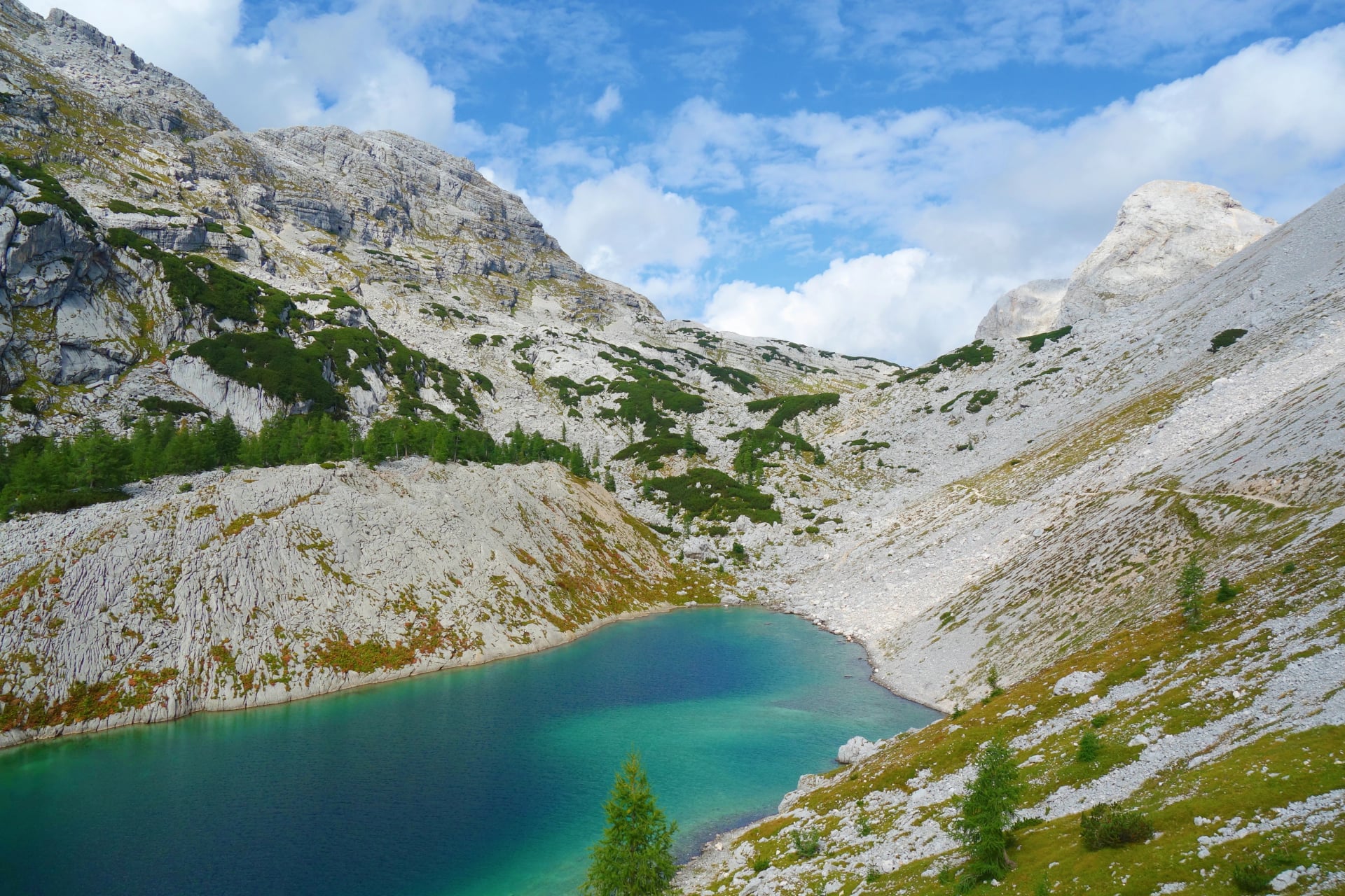
This Seven Lakes hike in Slovenia (also called the Triglav Lakes Valley hike) is one of the best full-day routes in Triglav National Park. It is a high alpine basin in the Julian Alps where lakes sit in limestone terrain shaped by alpine karst.
It is a classic Triglav National Park route that starts high above Bohinj, climbs through forest into traditional alpine pastures, then drops into a limestone lakes basin to the signature Dvojno jezero scene beside Koča pri Triglavskih jezerih. You are looking at 17.5 km, 870 m elevation gain and loss, and about 8 hours on the trail, with two hut stops along the way.

Step by Step Route Description
An about 8 hour hike that starts from a high point above Bohinj, climbs through forest into high alpine pastures, and finishes at the second mountain hut by Dvojno jezero as the main destination. Their tour stats list 17.5 km with 870 m elevation gain and loss.
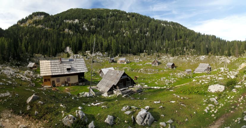
1. Planina Blato trailhead to the first hut and first pastures
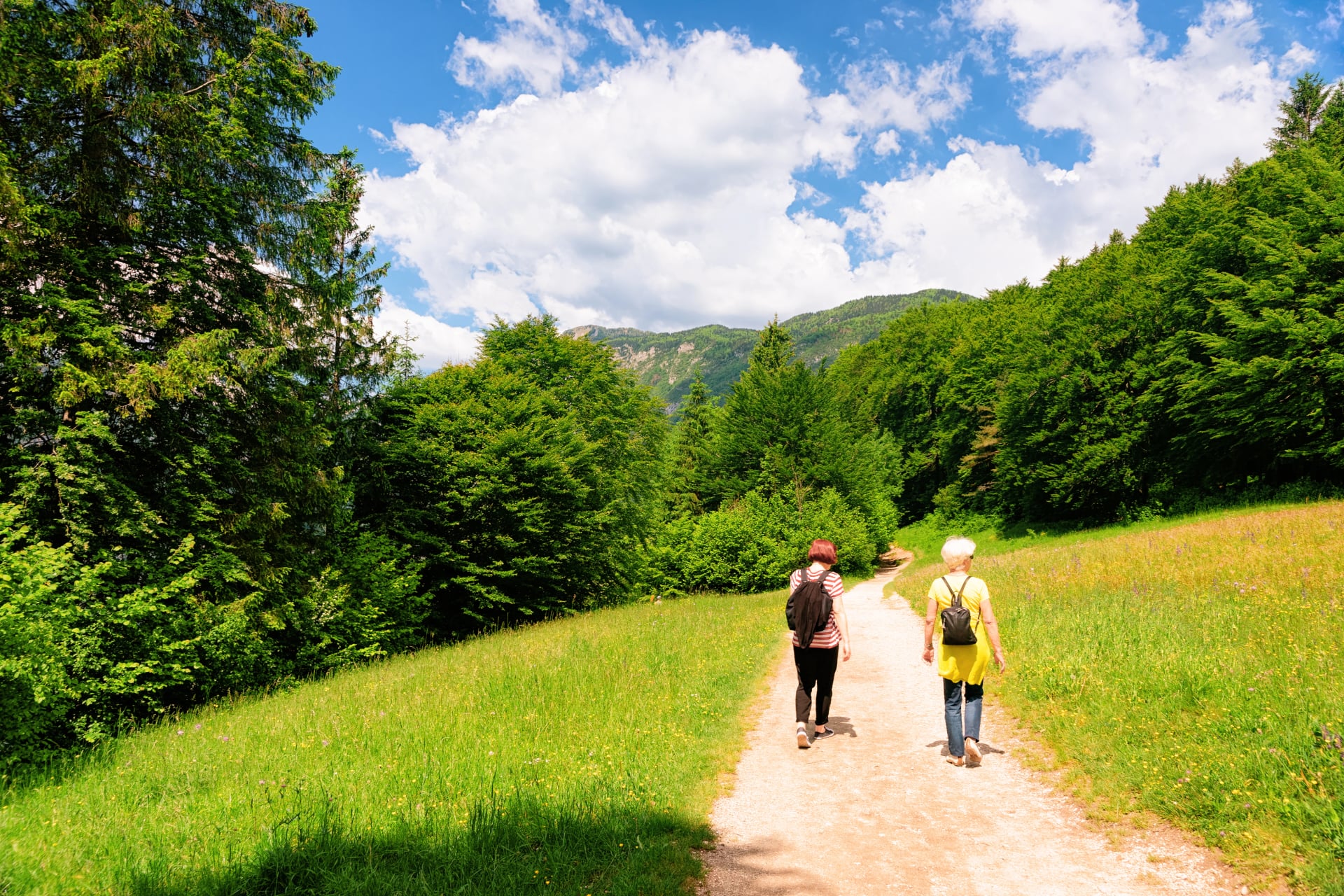
Start at Planina Blato, then follow the marked trail as it climbs through scenic forest. Keep a steady pace here, it is the warm up. As you gain height, the trees thin and you break out onto the first open pasture terrain, where the views start to open up.
2. Pastures and shepherd landscape
Continue across the remote mountain pastures, moving from one open grazing area to the next. This is where the route feels most like Bohinj, wide grassland, simple wooden buildings, and the sense of old alpine life. In summer, these pastures are still linked to traditional dairy production.
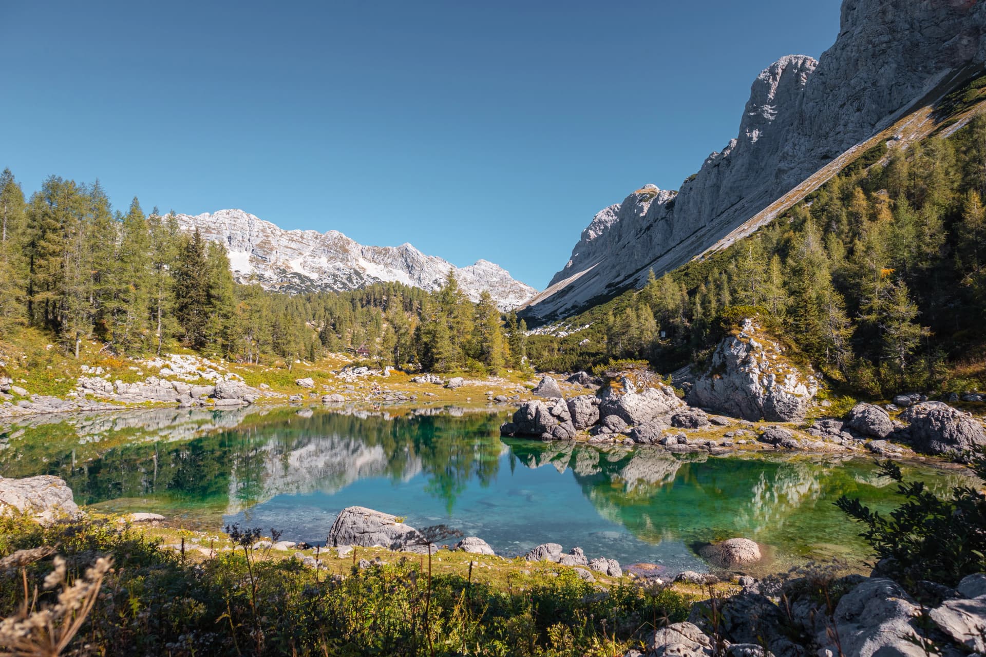
3. Higher terrain toward the lakes basin
From the pastures, keep climbing as the terrain gradually turns more alpine and rockier. The higher you go, the bigger the mountain backdrop feels, with more of the Julian Alps rising above the valley.
4. Two mountain huts
Use the huts as your rhythm. Stop at the first hut for a quick reset, then continue toward the second hut, the key target of the day. This is the best place for a longer break, a meal, and a cup of tea before you turn back.
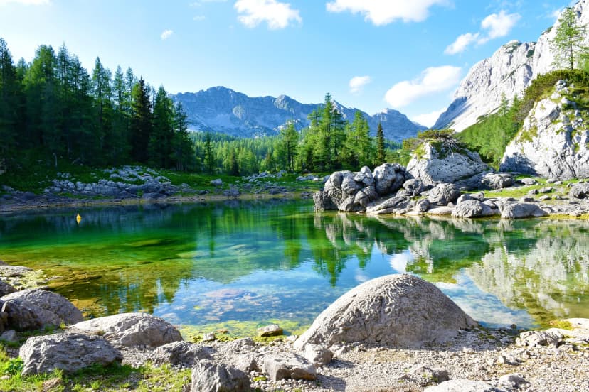
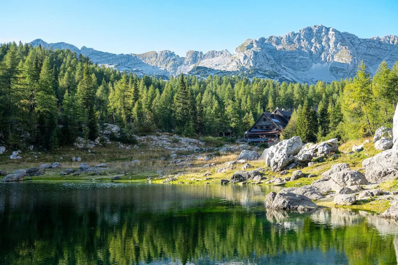
5. Dvojno jezero and Koča pri Triglavskih jezerih
Arrive at Koča pri Triglavskih jezerih, set beside Dvojno jezero. This lakeside scene is the planned main destination on the day hike itinerary and the natural turnaround point.
Optional Extension
More lakes sit higher up the valley, however the upper part is best enjoyed as part of a three day hike, rather than stretching a single day too far.
Return
From the hut by Double Lake, you head back the way you came, using the huts and pastures as natural pacing markers for a steady, comfortable hike out.
Add-ons and Extensions
These are the easiest ways to upgrade the standard day hike into something more complete, without turning it into a totally different trip.
Easy Add Ons from the Main Turnaround
Jezero v Ledvicah, Kidney Lake
A straightforward extension beyond Koča pri Triglavskih jezerih. The hike is about 45 minutes one way from the hut area.
Mala Tičarica
A classic summit add on when you still have energy. The ascend from Koča pri Triglavskih jezerih takes about 1 hour, with a panoramic view back over Dvojno jezero and the central valley.

Best Upgrades for Multiple Days
Zasavska koča na Prehodavcih, Prehodavci Pass hut
A classic next stop deeper in the valley, sitting above the upper Triglav Lakes Valley and often used on multi day hut to hut routes.Hribarice plateau and Čez Hribarice pass
A higher, wilder limestone world above the lakes that many longer routes use to connect toward Dolič and bigger Triglav group objectives.
Big Day Option for Strong Hikers
Loop that finishes via Komna and Črno jezero, Black Lake
A demanding full day loop that links the lakes area with the Komna plateau and passes Črno jezero on the way back.
Our Extra Tour Options
2-Day Hike
Overnight: Koča pri Triglavskih jezerih 1,686 m by Dvojno jezero
Day 1: hike from Planina Blato to Vodnikov dom takes about 4 hours
Day 2: explore deeper into the valley, then hike back out
This option keeps the same iconic destination as the day hike, but turns it into a proper lakes experience. You reach the hut with time to slow down, then use the second day for extra lakes and viewpoints that feel rushed on a single long day.
3-Day Hike
Overnight 1: Vodnikov dom na Velem polju 1,817 m
Overnight 2: Koča pri Triglavskih jezerih 1,686 m by Dvojno jezero
Day 1: hike from Planina Blato to Vodnikov dom takes about 4 hours
Day 2: traverse from the Velo polje plateau into the lakes basin and sleep by Dvojno jezero
Day 3: optional short add on near the lakes, then hike out
This is the best choice if you want the scenery without a big single day push. Day 1 gets you comfortably into the high alpine zone at Velo polje, Day 2 brings the main lake's payoff with a second hut night by Double Lake, and Day 3 leaves space for a short bonus walk before the hike out.
Mountain Huts: Food, Water, Toilets, Sleeping
Koča pri Triglavskih jezerih sits right by Dvojno jezero and is the key stop for both day hikers and hut to hut itineraries.

Food and Drinks
The hut serves hot meals and drinks, with typical options like stews, štruklji and zavitki.
Half board dinner is a choice from several set dishes, dinner is served until 8:00 PM, and they have vegetarian, vegan, and gluten free options, although they might be limited so it is highly advisable to bring your own snacks.
You cannot cook inside the hut, only outside with your own portable burner, and open fires are prohibited.
Water
There is a spring water tap in front of the hut and the hut states the water is drinkable.
Inside, there are sinks with cold water and water use is limited, which is normal for remote huts.
Toilets and Washing
Toilets and wash basins with cold water are available on the ground and upper floors, with a note that water consumption is limited.
Showers are not available, only wash basins for hands and face.
Sleeping
Capacity is 135 beds (46 beds in 15 rooms, 89 beds in 6 dormitories) split between private rooms and dormitories. Private rooms are limited (15 rooms in total) and get reserved pretty early.
Regular sleeping bags are not allowed. Bring your own clean hut sheet liner, or use disposable bedding provided by the hut for an extra charge.

Important Notes
Huts are seasonal and weather dependent so opening days can shift year to year, always check the current status before you commit to a route.
Beds are limited and sell out fast in peak summer so plan to reserve ahead if you want to sleep inside rather than gamble on walking in space.
Arrive early since many Slovenian hut reservations are only held until the late afternoon, after which your bed can be released.
Bring a sleeping bag liner and indoor hut shoes since huts expect you to take off hiking boots and sleep with a liner rather than a full sleeping bag.
Carry cash and expect weak connectivity because card payments and signals are not something to rely on in high huts.
Electricity and water are limited so charging can be shared and basic washing is typically at cold water basins rather than showers.

How to Get There
Most hikers stay around Lake Bohinj, especially Stara Fužina and Ribčev Laz, because they’re the closest villages to the access road for Planina Blato.
Getting to Planina Blato Trailhead by Car
Planina Blato is reached via the Voje, Vogar, Planina Blato forest road, which has a gate and a year round road management charge. In summer, Bohinj encourages using organised transfers instead of driving up in your own car.
Practical tip:
In high season, Bohinj parking areas can be full, especially on weekends, so do not count on arriving late and still parking at Planina Blato. If the upper parking is full, you may need to park lower down and use the organised transfers instead of driving up.

Organised Shuttles and Transfers
Bohinj runs seasonal organised transport to popular starting points. The official info hub is promet.bohinj, and Bohinj’s destination site points there for current timetables and ticket details.
If you want to reduce driving and parking hassle, look for transfers that serve the Voje, Vogar, Blato road corridor.

Public Transport and Taxi Workaround
Regular buses get you into the Bohinj area, but they do not always line up perfectly with the Planina Blato road access. If you’re not driving, the common workaround is a taxi from Stara Fužina up to Planina Blato.
Best Time to Hike and Trail Conditions
A quick way to think about this hike is that you are dealing with high alpine terrain where conditions can swing quickly, even in summer. The most reliable hiking window is mid summer, while early and late season can bring snow patches and much colder mornings at elevation.
When | What the trail is usually like | Why go then | Main watch outs |
June | Early season feel, but higher sections can still hold lingering snow patches depending on the year | Quieter trails and fresh alpine scenery | Snow patches and wet rock can slow you down, bring warmer layers for cold mornings |
July to September | Most reliable period for mostly snow free hiking in the high Julian Alps, with the clearest paths and longest daylight | Best overall window for a full day hike without winter gear | Peak crowds and common summer afternoon thunderstorms, plan an early start and earlier return |
Late September to October | Cooler temperatures and shorter daylight, conditions can shift quickly | Fewer people and crisp visibility on stable days | Early snowfall risk and very fast weather changes, conservative turnaround times matter |
After rain or during wet spells | Limestone and rocky sections are more slippery, especially on steeper parts of the route | Still doable with good judgement and pacing | Higher slip risk on wet rock and slower progress, take extra care on the steeper secured sections |

If you are aiming for the classic Seven Lakes Valley day hike experience with the least stress, plan for a stable forecast in July to September and build your day around an early start so you are descending before the typical storm window.
Essential Packing List
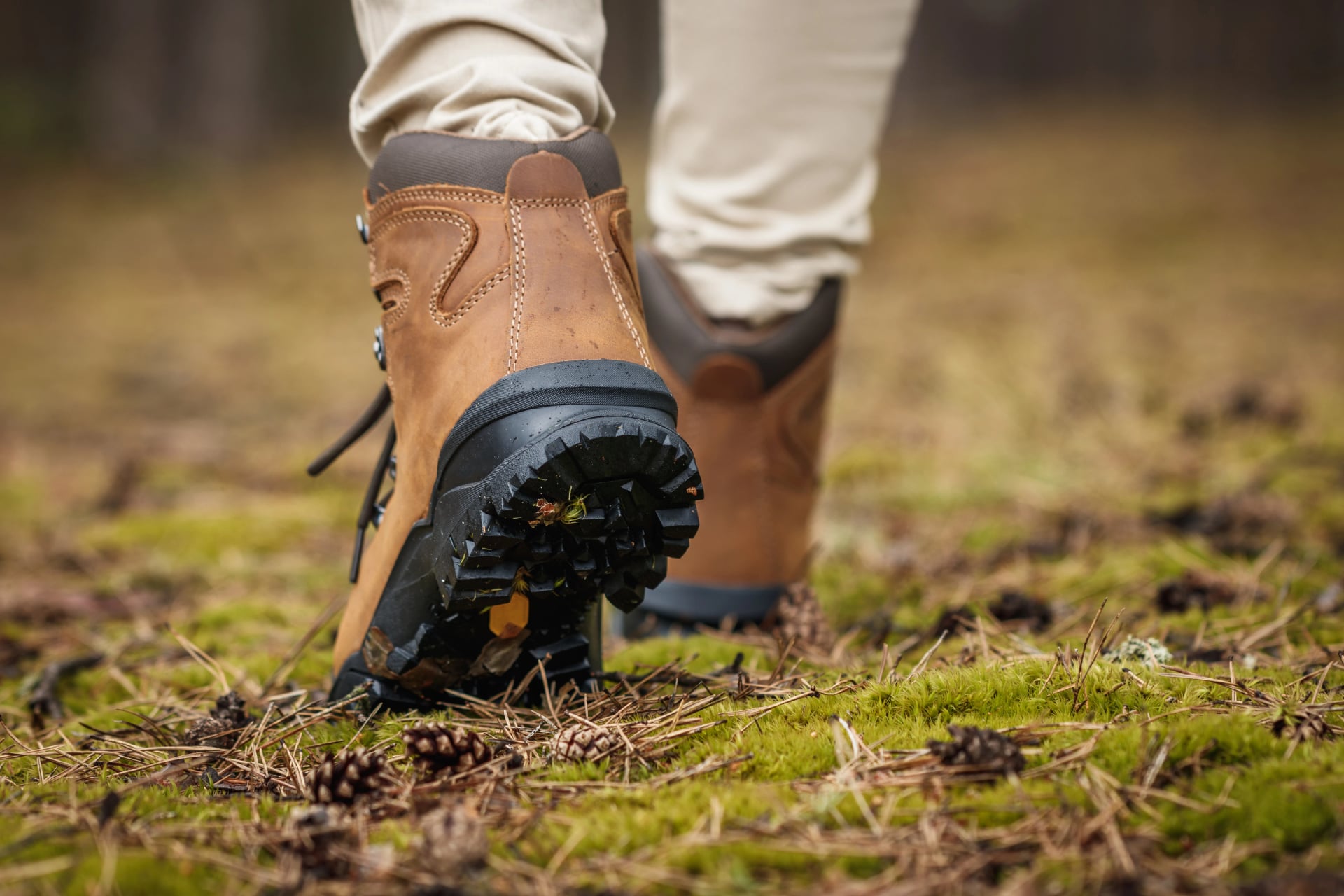
Footwear and Walking Gear
Broken-in hiking shoes or boots
Hiking poles (very helpful on long descents and uneven terrain)
Optional: light gaiters (early season snow patches or scree)
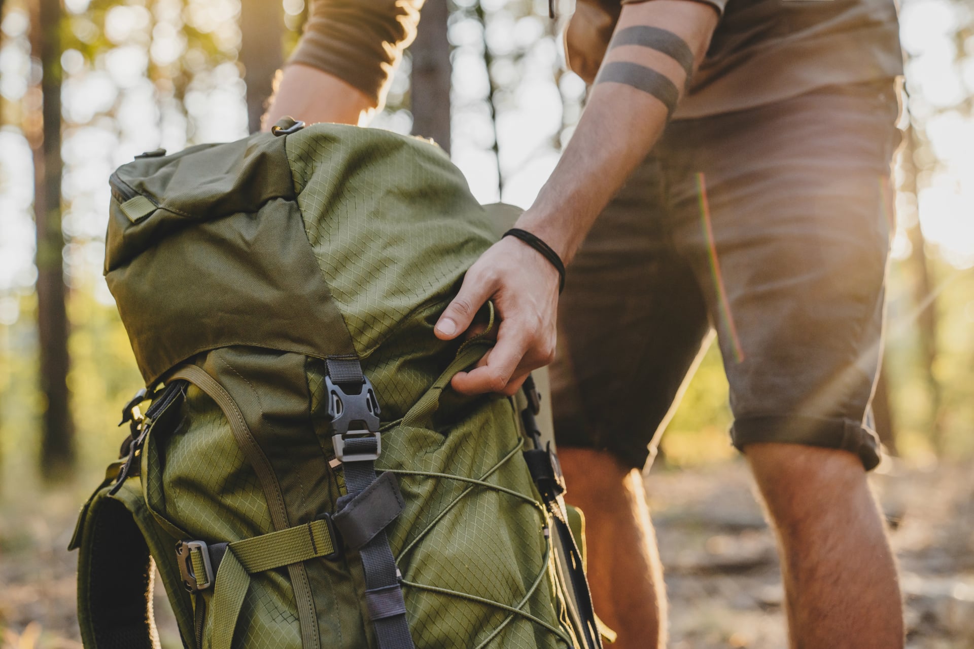
Backpack and Waterproofing
25 - 35L backpack
Rain cover or waterproof liner (one is enough)
Keep your pack lean: most people aim for roughly eight to twelve kilograms including water
Clothing Layers
Base layer (merino or synthetic, avoid cotton)
Lightweight hiking top for warm valleys
Mid-layer (fleece or light synthetic)
Insulation layer (light down or synthetic puffy for cold mornings and hut evenings)
Proper waterproof shell jacket
Waterproof pants (worth it when storms hit)
Hiking pants or shorts (depending on season)
Warm hat and light gloves
Sun hat or cap
Two to three pairs hiking socks, plus one spare set of underwear

Hut Overnight Essentials
Sleeping liner (generally required in Alpine huts; bring one even if bedding is provided)
Earplugs (dorms)
Small toiletry kit (toothbrush, travel soap), plus a small pack of tissues or toilet paper
Cash (some huts still rely on cash due to remoteness/connectivity)
Optional but useful: membership card (PZS / UIAA partner clubs) for hut discounts
Safety and Everyday Items
Sunglasses and sunscreen (plus lip balm)
First aid basics (blister care, pain relief, personal meds)
Headlamp
Phone with offline maps and emergency contacts
Water capacity for one and a half to two litres
Snacks for the gaps between huts (plus electrolytes on hot days)
Power bank (sockets can be limited)
Safety Notes
Start early in summer because afternoon thunderstorms are a common mountain pattern in Slovenia
If you plan to use huts, expect limited connectivity and do not assume card payments will work, carry cash as a safe backup
The Štapce line includes a steeper, more alpine feel section, slow down on wet rock and keep space between hikers on the secured parts
Use a mountain forecast rather than a lowland forecast, ARSO is the official source for Slovenia’s weather services

Ready, Set … Hike!
Ready for one of Slovenia’s most iconic mountain days. Start early, pace the climb so you reach the lakes with time to enjoy them, and turn around if weather starts building fast. Triglav National Park recommends good planning, the right gear, and letting someone know your plan before you go.
If you’d like help turning this into a smooth day-by-day plan, check out our tours or contact us—our local hiking experts can recommend the best stages for your dates and pace.

About this author
Uroš is our travel advisor and a kinesiologist who studied at the Faculty of Sport. An ultra-trail runner and sport climbing judge, he thrives wherever the next challenge waits — mountain biking, alpinism, or ski touring.