Alpe Adria Trail in Slovenia: Route Overview
A practical guide to the Alpe-Adria Trail’s Slovenia stages—from Kranjska Gora over Vršič to the Soča Valley—plus maps, logistics, and tips.

Uroš
Published February 11, 2026
Edited March 16, 2026
12 min read

Quick links
The Alpe-Adria Trail Overview
The Alpe-Adria Trail is a cross-border long-distance walking route that links the Alps to the Adriatic in 43 official stages over around 750 km. It starts at the foot of the Grossglockner (Austria’s highest mountain) and finishes in Muggia on the Adriatic coast near Trieste.
Countries and Regions
The route runs through three regions in three countries: Carinthia (Austria), Slovenia, and Friuli Venezia Giulia (Italy)—designed as a continuous journey, but easy to “slice” into shorter trips by choosing consecutive stages.
Slovenia Section at a Glance
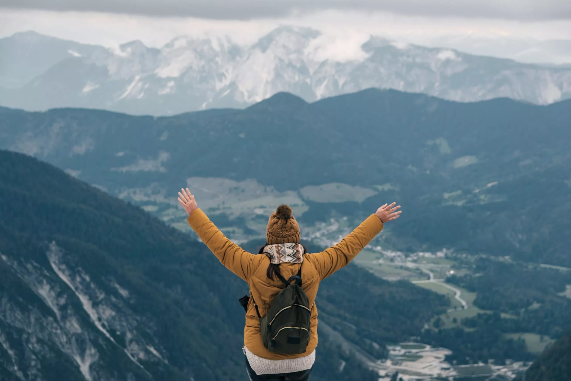
The Slovenia section is the most popular standalone slice of the Alpe-Adria Trail because it packs a full Alps-to-valley story into just a few days: a border ridge approach, the Vršič crossing, and then the Soča Valley all the way to Tolmin.
Quick Facts
Stages: E21–E25 (with E26 as an optional continuation into Italy)
Distance: 112.8 km total
Total ascent/descent: 3,642 m up and 4,317 m down across
Time needed: usually 5 stages, walked as 5–6 days depending on pace and breaks
Hardest days: E21 and E22 are the most demanding (longer time and bigger climbs); E24 and E25 can feel long late in the week.
Every day is built around a clear start and finish town, and the official stage cards give you the exact distance, elevation, and time estimates—so you can pick a 3–7 day version without having to “invent” your own route.
Where Does the Trail Go
In Slovenia, the Alpe-Adria Trail is a simple five-day story: a Karavanke ridge entry into Kranjska Gora, the Vršič Pass crossing, then a run of Soča Valley stages to Tolmin.
E22 Faaker See / Baumgartnerhöhe → Kranjska Gora
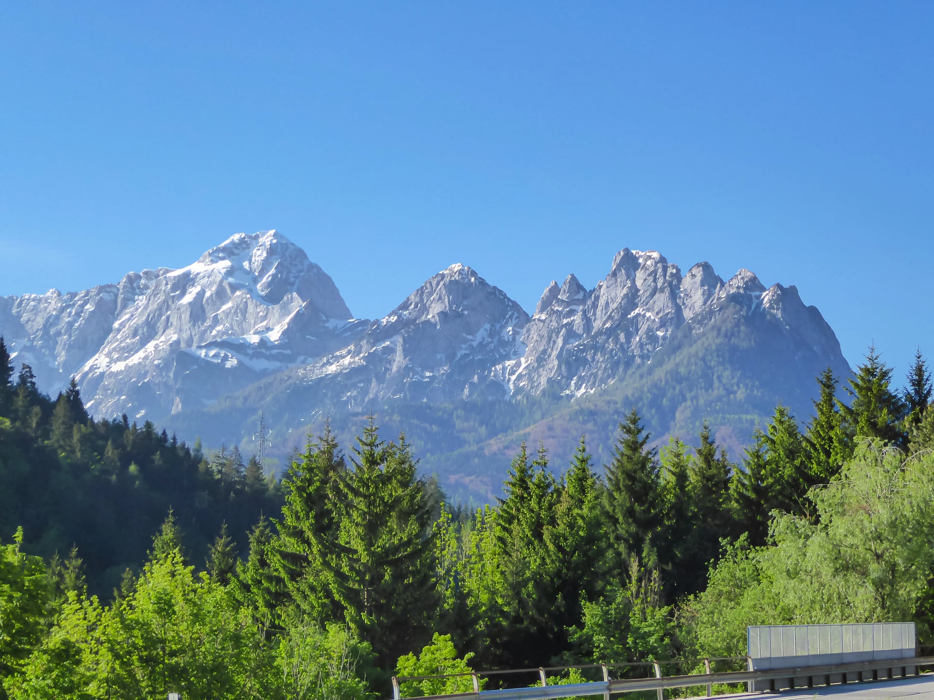
You start high above Lake Faak (Baumgartnerhöhe area) and quickly get into a true border-ridge stage: long stretches with the wind and wide views as you cross the Karawanks/Karavanke from Austria into Slovenia. Expect a big climbing/descent day with that classic “ridge walking, then a long drop” rhythm. The payoff is arriving in Kranjska Gora, a full-service mountain town right at the gateway to the Julian Alps.
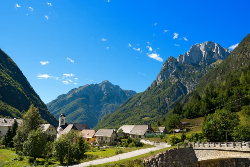
E23 Kranjska Gora → Trenta (via Vršič Pass)
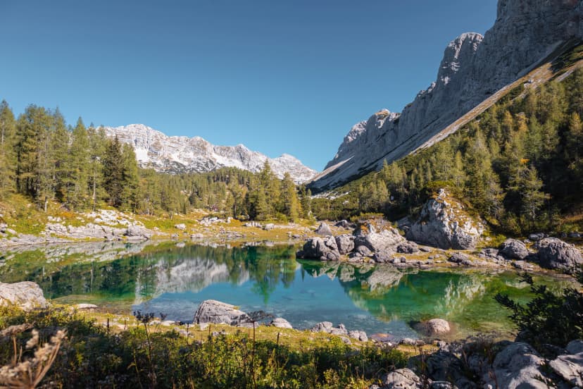
This is the signature mountain-crossing day. You leave town with an easy warm-up at Lake Jasna, then follow forest tracks and paths up the Pišnica valley alongside the stream, passing Mihov dom and the Russian Chapel before the climb continues on the old trail up to Vršič Pass. From the pass, you descend toward Trenta with big alpine scenery, and many hikers treat this as a “full-day epic” even if the trail isn’t technical.
E24 Trenta → Bovec
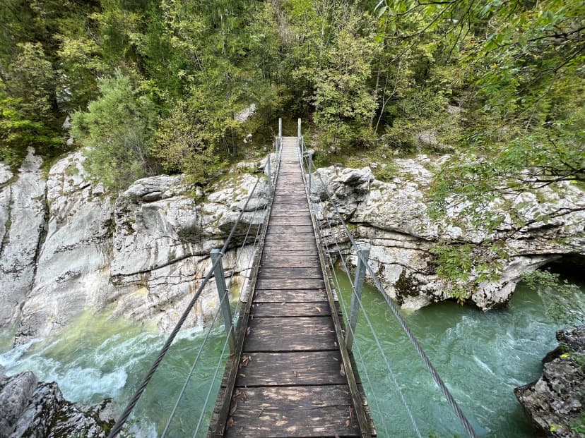
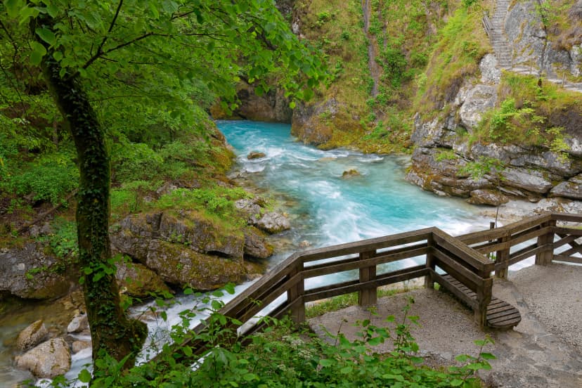
A very different feel: this is your Soča Valley flow day. The route follows the Soča Trail for long stretches, staying close to the emerald river and moving through forested riverbanks and open gravelly river scenery, with frequent “stop and stare” viewpoints. A standout moment is the suspension bridge over the Kršovec Gorge, near the Triglav National Park boundary, then you continue via the valley corridor (including the Soča/Koritnica confluence area) into Bovec.
E25 Bovec → Drežnica
You begin with a scenic valley section where a large part runs along the left bank of the Soča, so it feels like a relaxed river day at first. Later, the character shifts: you turn away from the river and finish with a noticeable climb up to Drežnica, a quiet hillside village above the Kobarid area—often arriving with that “end-of-day viewpoint” feeling. It’s not technical, but it’s a long, steady stage, especially if it’s warm.
E26 Drežnica → Tolmin
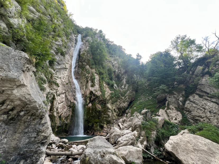
This is the most “story-rich” day: you follow former military paths and cross alpine meadows that carry strong WWI / Walk of Peace atmosphere, with a more remote, pastoral feel than the river stages. Along the way you pass waterfall and gorge areas (often mentioned: Brinta, Gregorčič, and Mrzli potok waterfalls), then you descend back toward the Soča and finish in Tolmin near the Soča/Tolminka confluence zone. Expect a mix of meadow traverses, historical traces, and a longer downhill into town.
The Slovenia section mixes a big mountain crossing day, easier valley walking, and a couple of longer stages where heat and cumulative distance matter more than technical terrain. A quick way to set expectations is to scan the official stage cards for distance, ascent/descent, and time estimates before you lock in your itinerary.
Difficulty and Preparation
The Slovenia section is approachable for regular hikers, but it still rewards smart planning. Most days are not technical, yet a few stages are long and the effort adds up over consecutive days.
Difficulty at a Glance
Endurance first: long days and consecutive walking matter more than technical terrain.
A few big stages: the Kranjska Gora and Trenta stages are the ones to budget extra time for.
Clear waymarking: logo plates on signposts plus occasional logo markings along the path.
Weather check habit: use ARSO’s mountain bulletin
Pacing wins: start easy on day one and day two so you finish strong later in the week.
Technical difficulty: low to moderate
Physical difficulty: moderate, with a couple of long days, that can feel demanding, if you are not used to consecutive walking days
Day-to-day Planning Habit
Before you commit to a stage each morning, do three quick checks:
ARSO mountain forecast for your region and elevation band
Any current-condition notes from local sources, especially after storms
If you’re heading into the hills, check reliable forecasts, trail conditions, and the avalanche bulletin when relevant
With the basics covered, you can now match the Slovenia stages to your pace and comfort level—so the week feels enjoyable, not like a grind.

Best Time to Walk
The most commonly recommended season is spring through autumn, with the clearest “base window” being April to the end of October.
If you want the simplest planning and the best chance of stable day-to-day walking conditions, late spring to early autumn is the sweet spot (think May through September). Many tour operators describe their practical season range as starting in April/May/June and running through September/October (sometimes longer depending on the specific itinerary and year).
For any dates near the edges of the season, make your decision based on conditions, not the calendar: check the local weather forecast (ARSO is the most reliable) before each stage.

Accommodation Along the Way
Most hikers do the Slovenia section inn-to-inn, sleeping in small towns and villages rather than mountain huts.
In practice, that means a mix:
guesthouses and pensions
small hotels
tourist farms
apartments

Overnight Towns on the Trail
The classic Slovenia corridor runs through places like Kranjska Gora, Trenta, Bovec, Drežnica, and Tolmin, all of which have established accommodation bases (with the widest choice usually in Kranjska Gora, Bovec, and Tolmin).
Booking Advice
Book earlier in peak season. The Soča Valley hubs (especially Bovec and the wider area) can get busy in summer, and availability narrows fastest for smaller villages.
Expect variety by stage. It’s normal to have a more “hotel/pension” night in a bigger base, then an apartment-style stay in a smaller place like Trenta.
Use an organized booking service if you want it simple. The Alpe-Adria Trail Booking Centre positions itself around reserving “trail rooms” with partner establishments and providing touring documents.
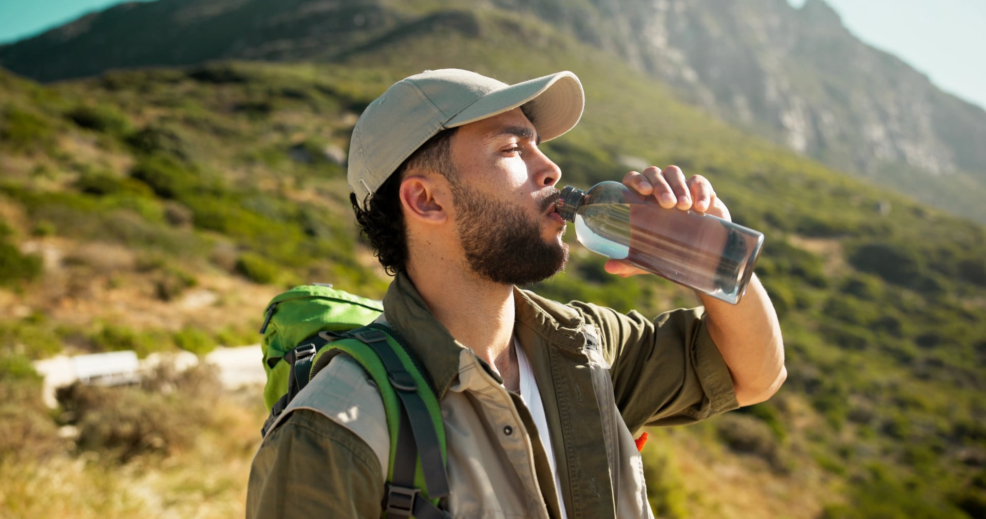
Food and Water
Food is easy: the Slovenia section is mostly village-to-village, so you’ll regularly pass places to eat and restock (especially around Kranjska Gora, Bovec, and Tolmin).
Plan around stage endpoints: the classic Slovenia flow runs through Kranjska Gora, Trenta, Bovec, Drežnica and Tolmin, which makes it natural to base meals around your overnight stops.
Water is usually manageable, but don’t rely on “random” sources: several stages follow the Soča corridor (for example Trenta → Bovec and parts of Bovec → Drežnica), so you’ll be near water a lot—but proximity does not automatically mean safe drinking water.
Budget expectation: one official trail story suggests roughly 70–80 EUR per day if you want to “eat and drink well” (accommodation and meals included), which is a useful reality check for planning.
On food, this is one of the most comfortable long-distance trails in the region because you’re not locked into hut dining. You finish most days in a settlement with at least a few options, and the “Alps to Adriatic” concept is very much tied to regional cuisine along the way—so it’s worth treating lunch stops and local dinners as part of the experience, not just fuel.
For water, the practical approach is simple: start the day with enough for a long stage, then top up when you can in towns, cafés, or at your accommodation. The Soča Valley stages explicitly run along the Soča Trail and river sections (including the Kršovec bridge area), so you’ll have plenty of opportunities to pause—just keep your drinking-water plan conservative and “known-source” whenever possible.
Transport Logistics
Transport is one of the best parts: you can arrive without a car, move between stage towns by public bus, and keep the whole trip point-to-point without complicated planning. The only real trick is to check timetables close to your travel day.
Arriving in Slovenia
For most hikers, Ljubljana is the easiest hub to fly into and connect onward by public transport. If you land at Ljubljana Jože Pučnik Airport (LJU), there are regular airport buses into the city, with the bus stop right outside the terminal.

Getting to the Start Point
If you’re starting the Slovenia section in Kranjska Gora, the simplest option is a direct bus from Ljubljana. The Ljubljana bus station publishes live timetables and tickets for the Ljubljana → Kranjska Gora route.
If you prefer mixing train and bus, you can take a train toward the northwest (for example to Jesenice) using Slovenske železnice’ timetable planner, then connect by bus/taxi onward to Kranjska Gora.
Getting from the Finish
If you’re finishing around Tolmin, there are direct bus connections back to Ljubljana, and the Ljubljana bus station also lists Ljubljana ↔ Tolmin services with timetable and online tickets.
Checking Timetables
Slovenia’s bus network is shared across operators, so for day-to-day planning it helps to check timetables in one of these places:

Once you’ve got your arrival and return sorted, the rest is just choosing your stage dates and daily rhythm. If you want to walk with a lighter pack, you can also build the trip around luggage transfer and shuttle support.
Navigation
This trail is designed to be easy to follow, but you’ll have the smoothest days if you pair the on-trail markings with one solid offline backup.
Each stage has a fixed start and finish, with clear planning info—distance, ascent/descent, and time estimates—so you can build your trip around your preferred daily effort.
Navigation is also designed to be straightforward: the trail is signposted to be walkable in both directions, usually by adding the Alpe-Adria logo to existing local hiking signs/markings, plus occasional logo paint marks along the path.

Waymarking
The trail is signposted so it can be walked in both directions. In practice, you’ll usually see an Alpe-Adria Trail logo plate attached to existing hiking signposts (sometimes it’s just a sticker), and you’ll also spot spray markings of the logo along the edge of the path.
Your Best Navigation Setup
On-trail signs first (follow the Alpe-Adria logo plates and direction boards).
Offline map backup on your phone for junction checks and confidence in low visibility. A strong local option is maPZS, the Slovenian Alpine Association’s official interactive hiking map.

If you’d rather focus on the trail’s best bits, take a look at our tour, which combines Alpe Adria highlights with selected Juliana Trail stages
How to Prepare
You do not need mountaineering fitness, but you will enjoy the trip more if you arrive with a base for consecutive days.
A simple approach that works:
Do one longer walk each week in the month or two before your trip, building up until a five to seven hour day feels normal.
Include at least one training day with a sustained climb and a long descent if your itinerary includes the Kranjska Gora to Trenta stage.
Start the first two days at a comfortable, conversational effort and aim to finish with energy left, not “empty.” That single habit improves everything: footing, mood, and recovery for the next morning.
Quick Tips
Use the “confirm early” habit: at every junction, don’t follow the most worn path—follow the next sign or logo marker
If you’re unsure, backtrack immediately: it’s faster (and safer) to return to the last confirmed sign than to keep “hoping” the trail will reappear
Keep one offline backup map: maPZS is a good local option for Slovenia because it’s built around the Slovenian Alpine Association’s trail data
Check for closures before you go: maPZS and mountain info sources often include updates on trail closures and disruptions, which can save you from a wasted climb.
Stay on marked trails: it reduces accident risk and makes rescue much easier if something goes wrong
Once you recognise the Alpe-Adria logo on the trail, navigation starts to feel pleasantly simple. You’ll mostly be doing quick “checkpoint” glances at junctions and signposts, then getting straight back to enjoying the walk—rather than constantly stopping to read a map.
If you’d like help turning this into a smooth day-by-day plan, check out our tours or contact us—our local hiking experts can recommend the best stages for your dates and pace.

About this author
Uroš is our travel advisor and a kinesiologist who studied at the Faculty of Sport. An ultra-trail runner and sport climbing judge, he thrives wherever the next challenge waits — mountain biking, alpinism, or ski touring.