Slovenian Mountain Trail: What to Expect and How to Plan it
From Maribor to the Adriatic: a practical guide to Slovenia’s classic hut-to-hut traverse, with sections, seasons, safety, and on-the-ground tips.

Quick links
Quick Facts at a Glance
Trail name: Slovenian Mountain Trail (SMT)
Start: Maribor
Finish: Debeli rtič (Ankaran)
Total distance: 617.4 km
Total elevation change: +37,300 m / −37,600 m
Typical duration: about 37 days, depending on speed
Official checkpoints: 80
Official checkpoints: 49 mandatory huts (+6 optional), 22 peaks, 3 museums
Waymarking: Knafelc blaze (red ring/white dot) + number 1
Trail Sections
You do not just walk from A to B. You walk through Slovenia’s main landscapes, one after another:
Pohorje – green ridges and plateaus that help you build rhythm early
Kamnik–Savinja Alps – sharper limestone terrain and more serious alpine days
Karavanke – long ridge walking with big panoramas
Julian Alps and the Triglav area – the most concentrated high-mountain character
Prealpine hills and plateaus → Karst Edge → coast – longer-distance days and a gradual shift toward the Adriatic finish

Route Overview and Planning Sections
The Slovenian Mountain Trail is a single cross-country traverse that naturally breaks into distinct sections: you start in the green, rhythm-building terrain around Pohorje, move through the main alpine ranges (Kamnik–Savinja, Karavanke, Julian Alps/Triglav), then transition into Prealpine hills, plateaus, and Karst before finishing above the sea at Debeli rtič near Ankaran.
If you hike in sections, this progression is your biggest planning advantage, because each chapter has its own season sweet spot and its own logistics.
Slovenia Mountain Trail Sections: Quick Overview
Section | Best for | Watch-outs |
|---|---|---|
Pohorje | Beginners, first multi-day trips, shoulder season | Easy terrain can be junction-heavy; long days add up |
Kamnik–Savinja Alps | Advanced hikers | More committing in bad weather; steep footing |
Karavanke Ridge | Intermediate hikers chasing views | Exposure can feel intense even when “not technical” |
Julian Alps | Strong alpine hikers | Conditions-sensitive; plan conservatively, check closures |
Prealpine Hills & Plateaus | Quieter middle/end of a traverse | Longer distance days; fewer resupply options |
Karst Edge & Coast | Off-season hikers, strong walkers | Heat and water planning become the main challenge |
Choosing Just One Part
Choose your section based on two things: your comfort with exposure and the season. Conditions can change quickly, so I follow GRZS’s simple rule before bigger days: check the forecast, trail conditions, and the avalanche bulletin when relevant. If you are not comfortable on exposed terrain or you are outside the main summer window, start with the lower and mid-mountain chapters and save the Julian and Triglav core for when timing and confidence line up.

Section by Section
Before you plan details, it helps to see the trail as a set of distinct sections, from Pohorje’s green plateaus through the main alpine ranges, then down into the Prealpine hills and Karst on the way to the Adriatic.
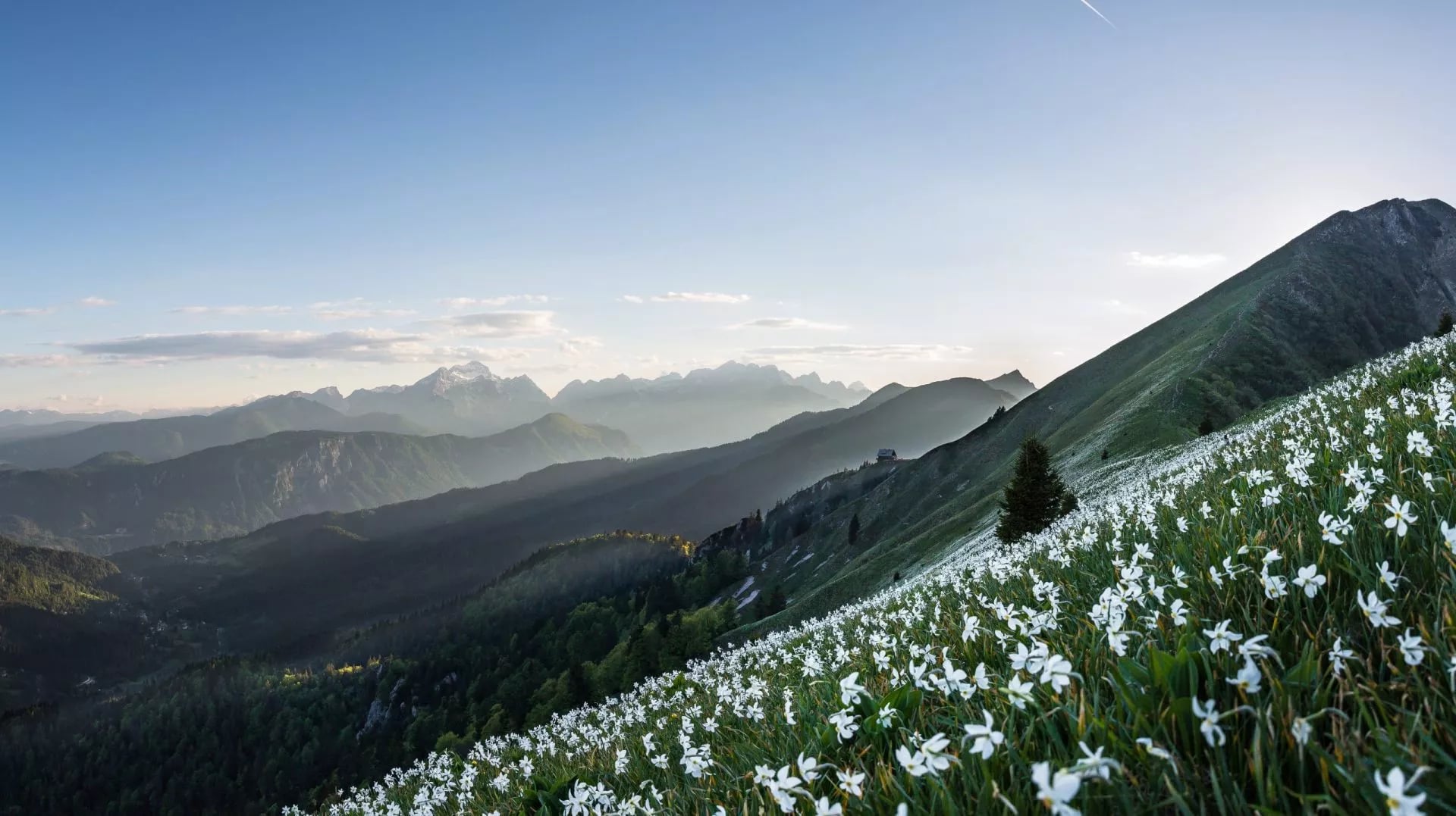
Pohorje
Long forest ridges and plateau walking, with boggy pockets and occasional wide-open viewpoints. It is mostly non-technical, but the days can be deceptively long, which makes it perfect for finding your steady multi-day rhythm early on. Pohorje is often described as a mix of forests, bogs, ravines, and open plains, and that variety is exactly what kept my first days from feeling repetitive.


Kamnik–Savinja Alps
This is where the trail starts to feel properly alpine: sharper limestone, steeper lines, and more serious footing. When the weather is stable it is incredibly rewarding, but when it is not, the margin for sloppy decisions shrinks fast, and I planned these days with the most respect. The official route is built around moving through Slovenia’s major mountain blocks, and this is one of the first places where you really feel that shift.


Karavanke Ridge
A ridge-forward chapter with airy crests, grassy sections, and sustained panoramas. It reads like a clean traverse along the border mountains, and I found it mentally easier to “stay in the story” here because the direction and views keep pulling you onward.


Julian Alps and the Triglav Area
This is the headline scenery: bigger peaks, rockier terrain, and the strongest high-mountain feel on the whole route. The intensity comes in waves, from exposed ridge movement to calmer valleys and lakes, and I treated it like the place where timing and conditions matter most, not the place to force a schedule. The trail’s best-known chapter runs through the Triglav area in Slovenia’s national park, which is part of why it feels so iconic.


Prealpine Hills and Plateaus
A long transition into quieter terrain: more rolling hills, forested plateaus, and a steadier walking cadence after the alpine core. It is usually straightforward underfoot, but the days can stretch out, and this was where I started thinking more about heat, timing, and simple efficiency than “mountain drama.”


Karst Edge and Coast
The landscape opens up into drier air and wider horizons as you approach the Adriatic, and the trail shifts again into a very different kind of walking. Technically it is simpler, but on warm days the real task is pacing and water discipline, and the finish above the sea at Debeli rtič feels satisfying precisely because the country has changed so clearly beneath your feet.


Huts & Accommodation
On the SMT, sleeping plans are not an afterthought. The route links huts and key points, so the mountains naturally fall into a hut-based rhythm: walk until late afternoon, arrive where you can eat and sleep, and repeat.
What surprised me most is how much a good hut night improves the next day. It resets your body, but it also resets your decision-making, which matters when tomorrow could be a gentle ridge walk or a more exposed alpine stage. In the Triglav area, huts operate in a remote environment with limited resources, and visitors are asked to be considerate because it is genuinely hard to meet every demand in peak season.
Most huts feel simple and communal rather than private and quiet. Think shared tables, dorm rooms, and a practical menu that exists to refuel hikers. Booking becomes much more important in the busiest parts of the Julian Alps, so I plan that chapter first and keep the rest of my itinerary more flexible.

What I always bring for hut nights:
Not a giant packing list, just the few things that consistently make hut life smoother:
A sleeping liner
Cash as a default payment option in more remote places
Earplugs for shared rooms
Food, Water & Resupply
Food is usually the easy part. When huts are operating, most days can run on a simple rhythm: eat properly at your overnight hut, top up with something warm when you pass another hut, and carry snacks for the gaps.
Water deserves more respect. Triglav National Park explicitly notes the reality of limited resources in remote hut operations, and Slovenian rescue guidance emphasizes checking conditions before heading out. In practice, I plan refills around reliable sources and I do not assume I will “just find a stream” when the terrain gets limestone and dry.
Resupply is straightforward if you think in light buffers rather than carrying days of food. The trail drops into settled areas often enough that you can restock, then return to the mountains with only what you need. The friction points are usually payment and timing, so cash and a small emergency snack meal are the simplest fixes.

A few habits that keep this simple:
Start each day with enough water to comfortably reach your next reliable refill, and top up whenever you have a sure source.
Carry cash as your default for huts.
Keep snacks as “gap fuel” so you are not dependent on perfect timing for hut meals.
Markings, Maps, and Daily Checks
The Slovenian Mountain Trail is one official line across the country, but you can hike it in the format that fits your life. Some people go end to end in one journey, others stitch it together over multiple trips and seasons. Both approaches match how the trail is used in practice.
On the ground, navigation is usually straightforward once you know the system: look for the Knafelc blaze (white dot in a red ring) and, for the SMT specifically, the number 1 alongside it.
Still, I would not rely on markings alone, because the easiest terrain is often where people drift off route.Still, I would not rely on markings alone, because the easiest terrain is often where people drift off route. Forest junctions, village turns, and farm tracks can be surprisingly tricky when you are tired.

Checkpoint stamps and the official logbook exist as an optional extra some hikers enjoy. They are not a requirement for hiking the route well.
Two checks make the whole trail safer and calmer:
Trail status and closures: Alpine Association trail status site
Mountain forecast: ARSO forecast before committing to bigger stages. Use a translator if needed.
Checkpoint stamps and the official logbook exist as an optional extra some hikers enjoy. They are not a requirement for hiking the route well.

Best Time to Hike
Most people should plan the Slovenian Mountain Trail around when the high mountains are most likely to be clear and the hut-to-hut rhythm works best. For the alpine core, that typically means the main summer season, while the lower chapters are more flexible and can be excellent in shoulder season. For day-to-day decisions, I rely on ARSO’s mountain bulletin because it breaks conditions down by range, which is exactly how the Slovenian Mountain Trail moves across the country.
For more detailed information about the best time to go hiking in Slovenia, you can check out our blog.

Transport Logistics
The SMT is surprisingly workable without a car, mostly because it keeps dropping into valleys and towns between mountain blocks. The start in Maribor and the finish near Ankaran are both connected to Slovenia’s wider public transport network, so the main transport challenge is not the endpoints, but getting to specific trailheads in the high Alps at the right time of day.
In the Triglav National Park area, this is getting easier every year because there are dedicated mobility pages and seasonal shuttles that link popular access points and reduce parking pressure. A good example is the Vrata Valley bus running from Mojstrana toward key starting points in summer.

For planning, I do two things: I choose section endpoints near a settlement with reliable connections, and I sanity-check the day with local tools before I commit. maPZS is the most practical map reference for official trails.
Our Planning Advice
Let the trail build you up. I would start with an easier block to lock in routine and “trail legs,” then save the most exposed alpine days for when my fitness and confidence are steady.
Plan the Julian and Triglav part first. That is the section where conditions and logistics matter most, so I would build the rest of the journey around the best weather window and what is realistically open.
Use the same three checks every morning: trail disruptions on the Alpine Association’s status page and the ARSO mountain forecast (plus the avalanche bulletin when relevant).
Navigate calmly, not bravely. Follow the markings, but keep an offline backup map for junction-heavy “easy” days.
Finish with margin. I would rather end each day with enough time and energy to eat, recover, and think clearly than squeeze in one more hour and pay for it tomorrow.

Finishing the Slovenian Mountain Trail felt less like ticking off stages and more like living inside Slovenia for a while, one day at a time. I enjoyed it most when I stayed flexible and kept the basics simple: check trail status, check the mountain forecast, and carry a reliable map backup.
If you’d like help turning this into a smooth day-by-day plan, contact us and our local hiking experts will recommend the best stages for your dates and pace.
We also prepared two shortened itineraries on the SMT that cover its biggest highlights. Check them out below:


Expert Local Guides
Our professional guides know the local terrain and are trained to make this once-in-a-lifetime opportunity both safe and enjoyable.

Hassle-Free
We handle route planning, accommodations, transfers, and anything else you prefer not to deal with, so you can enjoy a carefree hike.

Tried & Tested Adventures
Only the best hiking adventures in Slovenia, cherry-picked by our local team with an in-depth knowledge of the region.

Book with Confidence
We are a financially protected company, fully bonded and insured, keeping your money safe and allowing you to travel with confidence.

Unbeatable Support
Our 24/7 customer support is where we show our passion, bringing you a better experience by making your well-being our number one priority.